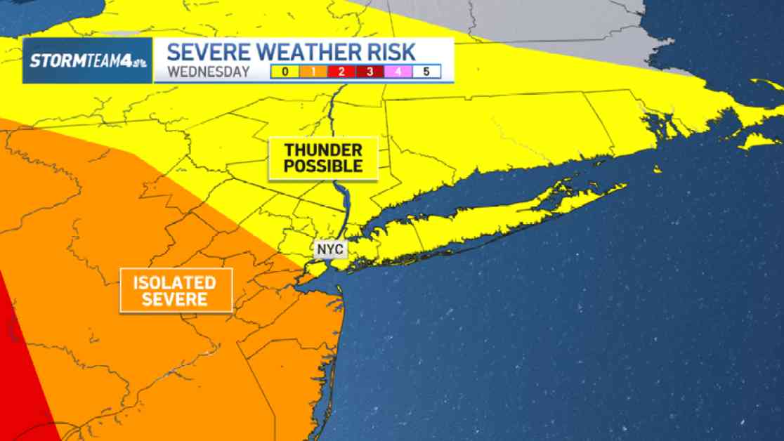
After a brief cold snap, spring temperatures have finally returned to the tri-state area. However, with the change in weather comes the inevitable arrival of spring showers and thunderstorms. As meteorologists predict severe thunderstorms with heavy rain, residents in New Jersey and New York City are urged to prepare for potentially disruptive weather conditions.
Impending Storms and Rainfall
The looming cold front is expected to trigger showers in regions such as the Hudson Valley, Catskills, and Poconos as early as Wednesday morning. These initial showers are forecasted to be light and shouldn’t pose significant challenges for commuters, with intermittent wipers likely being sufficient. However, the calm before the storm will be short-lived in New York City, where rain is anticipated to roll in during the afternoon hours.
As the day progresses, a heavier line of showers and storms is projected to sweep through the area between 5 p.m. and 8 p.m., coinciding with the evening commute. To avoid being caught off guard by the inclement weather, it is advisable to carry an umbrella and rain jacket throughout the day. Commuters are advised to plan for potential delays and allocate extra time for their journey home due to the anticipated adverse weather conditions.
Potential Impacts and Precautions
With the possibility of some of the heaviest downpours leading to minor flooding, particularly in low-lying or poorly drained areas, precautions should be taken to ensure safety on the roads. Ponding or minor flooding could increase the risk of hydroplaning for vehicles, emphasizing the importance of exercising additional caution while driving in adverse weather conditions.
While central and south Jersey are expected to bear the brunt of the strongest storms, other regions including the Hudson Valley, Connecticut, NYC, and Long Island are likely to experience weaker yet still impactful thunderstorms. Residents are encouraged to stay informed about the latest weather alerts for their respective neighborhoods to stay prepared and safe.
In anticipation of the storm’s arrival, it is recommended to secure outdoor items such as garbage cans, furniture, and decorations to prevent them from being displaced or causing damage. As the line of storms passes through swiftly, rainfall amounts ranging from half an inch to an inch are expected across most areas, with the potential for over an inch in regions north of the city.
Post-Storm Outlook and Long-Term Benefits
Despite the inconvenience posed by Wednesday’s anticipated rainfall, the much-needed precipitation will help alleviate the moderate to severe drought conditions that persist in many areas following last fall’s dry spell. As the storms clear out, cooler temperatures are set to follow, bringing a slight cooldown of 5 to 10 degrees by the upcoming weekend.
For those yearning for warmer weather, there is a silver lining on the horizon as temperatures are forecasted to rise into the 60s in the following week. While the impending storms may disrupt daily routines and travel plans, they also offer a vital respite for drought-stricken regions and a promise of more seasonable weather to come. So, as the rain clouds gather and thunder rumbles, remember to stay safe, dry, and optimistic about the beneficial impact of this spring storm system.


